A seven-story mixed-use development near the NuLu district hit an unexpected layer of loose alluvial sand at 18 feet last spring. The initial boring logs suggested a straightforward spread footing design, but the Standard Penetration Test (SPT) told a different story. Blow counts dropped below 6 in that zone, and the geotechnical team had to pivot to a deep foundation system to avoid differential settlement. That kind of subsurface surprise is common in Louisville, where the Ohio River’s historic meandering left behind a patchwork of glacial outwash, lacustrine clays, and weathered limestone residuum. An SPT boring captures both the sampler recovery and the resistance profile, giving engineers a direct, repeatable measure of relative density and consistency. When we run SPT testing in Louisville’s urban core, we correlate N-values with laboratory grain size analysis to confirm soil behavior type and with Atterberg limits when the fines content exceeds 12 percent, ensuring the classification holds up under scrutiny.
An SPT boring in Louisville’s alluvial plain is not just a number on a log—it’s the first line of defense against mischaracterizing a compressible silt layer that could compromise a foundation.
Our approach and scope
Local geotechnical context
Louisville sits at an elevation of roughly 466 feet above sea level along the Ohio River, and the 2008 Wabash Valley seismic zone event—a magnitude 5.2 centered in southern Illinois—served as a sharp reminder that felt shaking reaches the metro area. The combination of low-elevation alluvial deposits and a shallow water table in the South End and along Beargrass Creek creates conditions where SPT N-values can drop into the single digits for 15 feet or more. When that loose saturated sand is present, the risk of liquefaction-induced settlement under a design earthquake is real, and the SPT dataset becomes the primary input for simplified procedures like the Seed-Idriss cyclic stress method. Without adequate SPT coverage, a site classified as Site Class D under ASCE 7 could be mistakenly treated as Site Class C, altering the seismic design category and the required detailing for structural connections. In Louisville’s older industrial corridors, undocumented fill with brick fragments and cinder debris further complicates interpretation, making the refusal depth and the refusal N-value critical parameters for deciding whether to terminate borings or switch to rock coring.
Applicable standards
ASTM D1586-18: Standard Test Method for Standard Penetration Test (SPT) and Split-Barrel Sampling of Soils, ASTM D4633-16: Standard Test Method for Energy Measurement for Dynamic Penetrometers, ASCE 7-22 Chapter 20: Site Classification Procedure for Seismic Design, IBC 2021 Section 1803: Geotechnical Investigations
Complementary services
Foundation Design Borings
SPT borings at footing and pile locations for spread footings, mat foundations, and driven piles, with N-values used to estimate bearing capacity and settlement parameters in Louisville’s residual soils.
Liquefaction Assessment
SPT-based cyclic resistance ratio (CRR) evaluation in the Ohio River floodplain, following Seed-Idriss and Andrus-Stokoe methodologies for projects requiring a site-specific seismic hazard analysis.
Pavement Subgrade Investigation
SPT soundings along proposed roadway and parking lot alignments to correlate N-values with CBR for both flexible and rigid pavement design under Louisville Metro Public Works standards.
Typical parameters
Common questions
How many SPT borings does Louisville Metro require for a commercial building?
The IBC 2021, adopted by Louisville Metro, requires a minimum of one boring per 2,500 square feet of building footprint for structures under 100,000 square feet, with at least one boring penetrating to a depth where the stress increase is less than 10 percent of the existing overburden. The actual number is determined by the geotechnical engineer of record based on the variability of Louisville’s subsurface conditions. Sites near the Ohio River with known alluvial deposits typically need additional borings to capture lateral variability.
What is the typical cost for an SPT boring in Louisville?
For a standard SPT boring in the Louisville area, the cost generally ranges from US$580 to US$680 per boring, assuming depths between 30 and 50 feet with typical access conditions. This includes the drilling, sampling, field logging, and the N60-corrected report. Costs increase when traffic control is required downtown, when borings exceed 60 feet, or when rock coring is needed after refusal is encountered on the Jeffersonville limestone.
How does the SPT help with liquefaction analysis in the Ohio River Valley?
The SPT provides the normalized blow count (N1)60cs, which is the primary input parameter for the simplified liquefaction triggering procedures developed by Seed and Idriss and updated by the NCEER working group. In Louisville’s floodplain deposits, we use the SPT data to calculate the cyclic stress ratio (CSR) induced by the design earthquake and compare it to the cyclic resistance ratio (CRR) of the soil layer. Layers with (N1)60cs below 15 in saturated sands typically require further analysis and possibly ground improvement if the factor of safety is below 1.1.
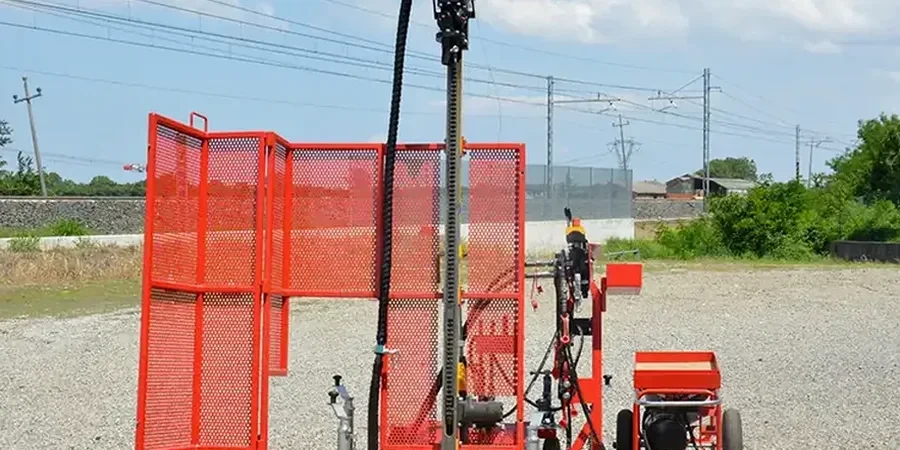
Can SPT borings be performed in limited-access areas like basements or tight urban lots in Louisville?
Yes, limited-access SPT drilling is routinely performed in Louisville’s urban infill sites, including basements, alleys, and areas with overhead clearance restrictions. We use compact track-mounted rigs that can pass through a standard 36-inch doorway, or portable tripod setups for extreme access constraints. The SPT hammer energy calibration remains valid regardless of the rig size, and we document any deviations from the standard 30-inch drop height in the boring logs so that the N60 correction remains transparent.